Section 4: Land Use and Natural Features
By Dan Reiff, October 2009
The Timberlake neighborhood is centered over a low ridge stretching from Alcoa Highway to Fort Loudon Lake. Although the road seems to curve up and down a single hill, there are several separate hilltops in the neighborhood boundary which are accessed by the side lanes that branch off the main ridge line. Most of the land remains wooded, and soils are classified as Coghill-Corryton complex series (characterized as very deep, well drained and moderately permeable), over a bedrock of shale and limestone. The soil is strongly to moderately acid and contains chunks of calcareous sandstone and shale.
With reliable irrigation and soil suitable for agriculture, not surprisingly, most families living around the Timberlake area in the early half of the 20th century were farmers. The McCarrell family settled immediately to the south, and a spring-fed creek originating along the southeast side of Timberlake Drive at bears the “McCarrell Springs” name on a 1978 TVA map. There is no claim to this water. In 2008, Nathan Callaway (3612 Timberlake) took advantage of the flow and devised a yard irrigation system that pumped water collected from the spring. He estimated the flow to be around 300 gallons per day.
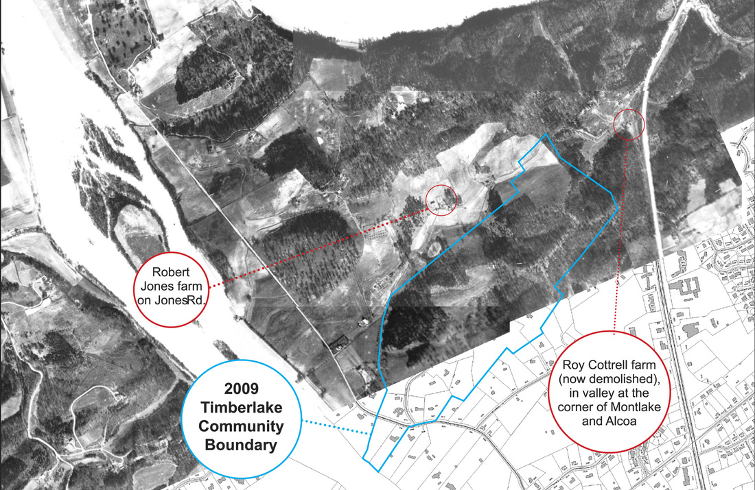
1935 Aerial overlay (click to enlarge) showing farms and land clearing
Another spring is located on the northeast side of the ridge, originating on or near lot 26. The Roy Jones farm was located in the valley to the northwest along Montlake Drive, and all deeds for lots 22 and 24 since 1920 (when the Chapmans purchased the land from Jones) have conveyance for a pipeline right-of-way to the Jones property from the spring. The 1935 aerial photograph in Figure 1-B shows the land use prior to residential development. There have been accounts of strawberries and sweet potatoes being among the crops grown in the cleared area at the corner of Montlake and Timberlake, and hog lots reportedly stretched from Montlake into the lower back corners of 3601 and 3523 Timberlake (lots 20 and 22).
Another cleared area occurred through the center of the Maloney Heights subdivision along a natural swale that follows the contour of Timberlake Drive from 3517 (lot 24) down past 3613 (lot 16). The clearing then continued around lot 14 encompassing lots 6, 5, 4, and 3, to the north corner of Maloney Drive, an area bordered by the creek behind the former Maloney cabin property. Prior to the Timberlake roadway, this would have been the most accessible land in the subdivision. Recent aerial photos of this section are shown in Figures 4-A and 4‑B (click to enlarge).
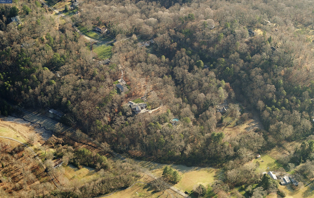
Figure 4-A: View of northwest section of Timberlake area along creek, looking southeast across Montlake Drive
Source: Bingmaps.com - bird’s eye view (2007)
|
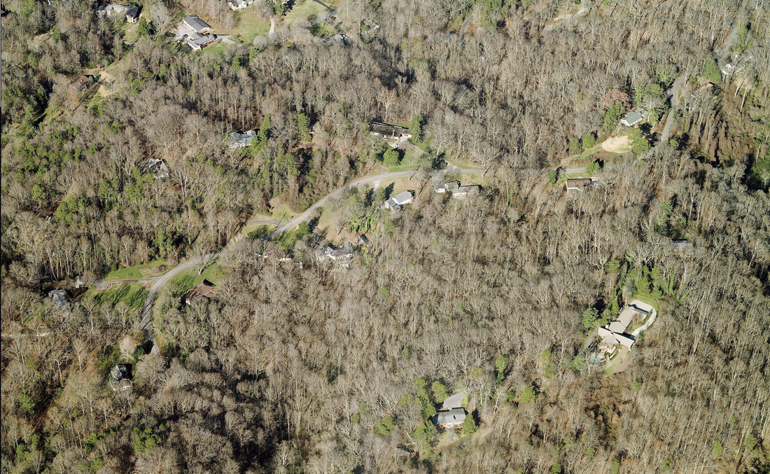
Figure 4-B: View of central section of Timberlake area along creek, looking north
Source: Bingmaps.com - bird’s eye view (2007)
|
Table 4A tracks the sequence of home building and cleared land by referencing TVA maps dated 1942, 1953, 1966, and 1978. Timberlake area details of the four TVA Maps are shown on following pages in figures 4-C through 4-F. The full set of 1942, 1953 and 1966 TVA maps showing the wider area are available online at www.lib.utk.edu/map/tnmap/.
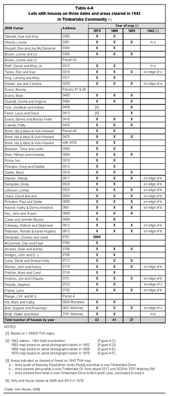
Table 4-A
|
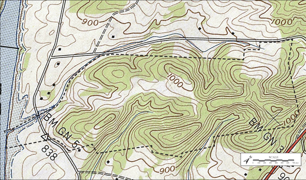
Figure 4-C: 1942 TVA Map (Timberlake Area Detail) Map source: http://www.lib.utk.edu/map/tnmap/
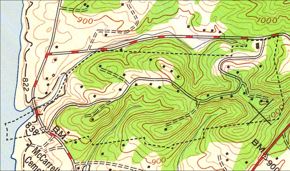
Figure 4-D: 1953 TVA Map (Timberlake Area Detail) Map source: http://www.lib.utk.edu/map/tnmap/
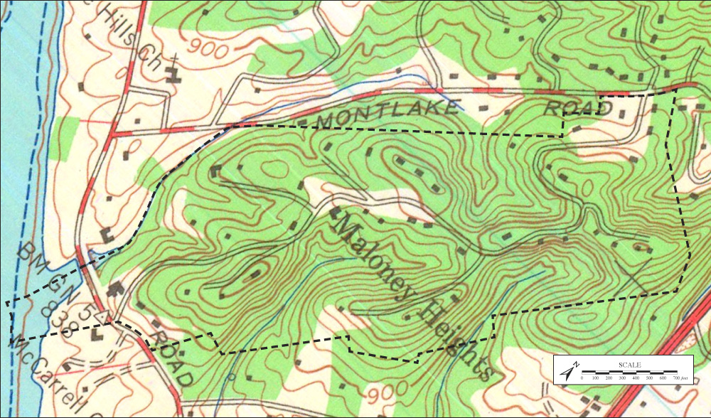
Figure 4-E: 1966 TVA Map (Timberlake Area Detail) Map source: http://www.lib.utk.edu/map/tnmap/
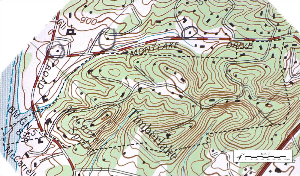
Figure 4-F: 1978 TVA Map (Timberlake Area Detail) Map source: scan of Rennie map
|
Topography
Land elevation of the Timberlake neighborhood property ranges from the lowest point at the lake contour of 822' above sea level (along the creek on the northwest boundary), to the highest point of approximately 1,100' at lot 36 (3412 Timberlake), which forms the western bluff along Alcoa Highway. Timberlake Drive climbs from 940' at Montlake to 1,060' at the lane entrance at lot 33 (3400 Timberlake) then descends to approximately 840' at Maloney Road. According to O.A. Grave’s description of the road to the Knox County Planning Commission in 1948, the road has gradients of not more than 10 percent, except in three short stretches of 150-200 feet where it is 12 percent. Figure 4-H shows a modeled topographic contour of the Timberlake area.
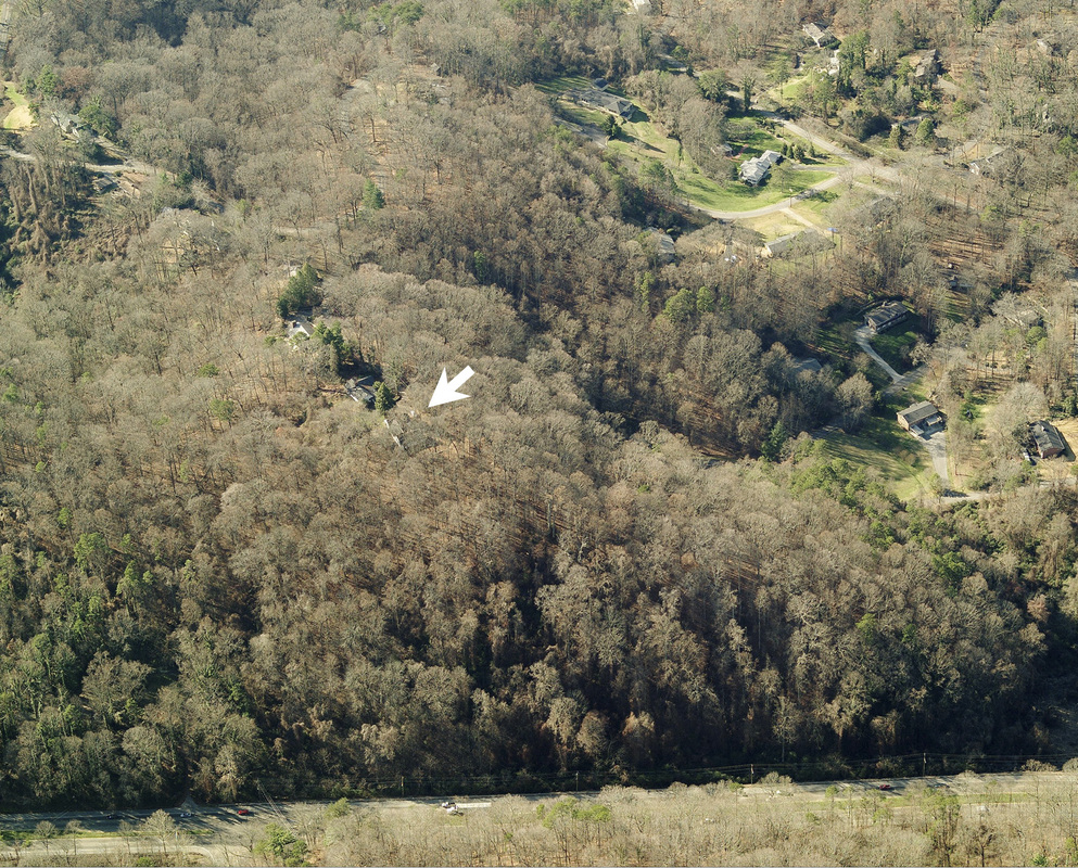
Figure 4-G: Highest elevation in the Timberlake neighborhood, view looking northwest across Alcoa Highway
Source: Bingmaps.com - bird’s eye view
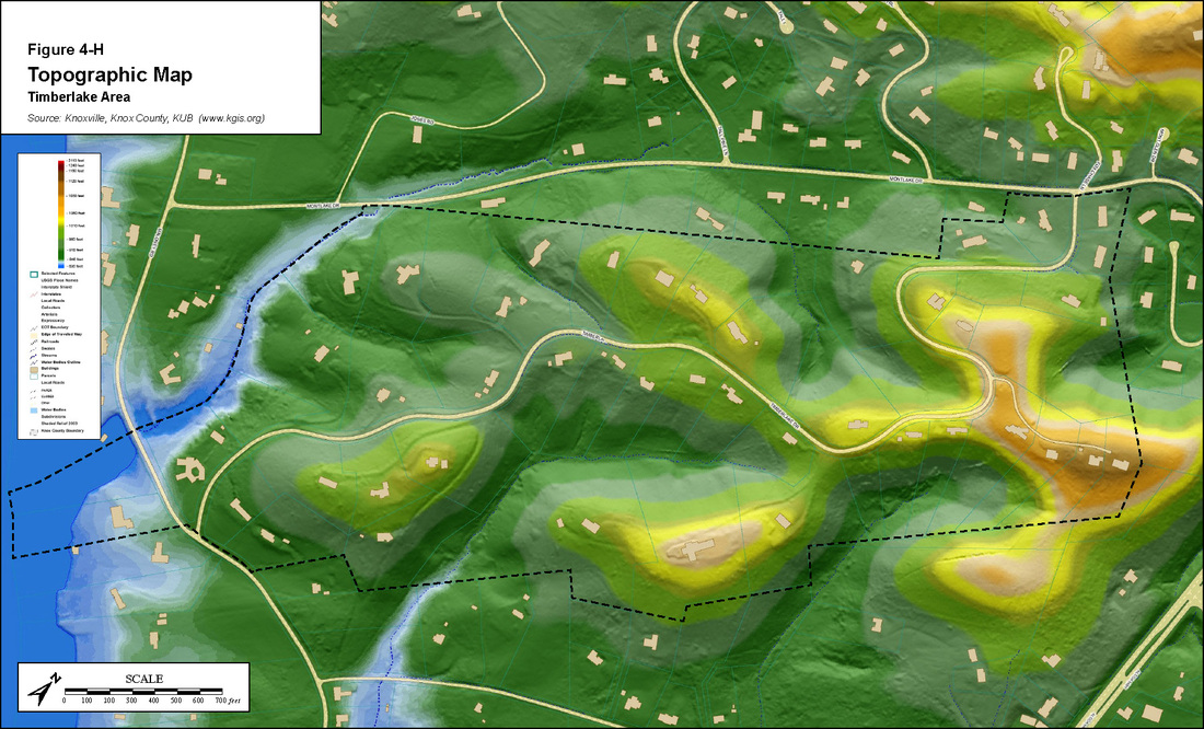
Figure 4-H: Topographic Map of Timberlake Area (source: knoxgis)
Loudon Lake Dogwood Trail
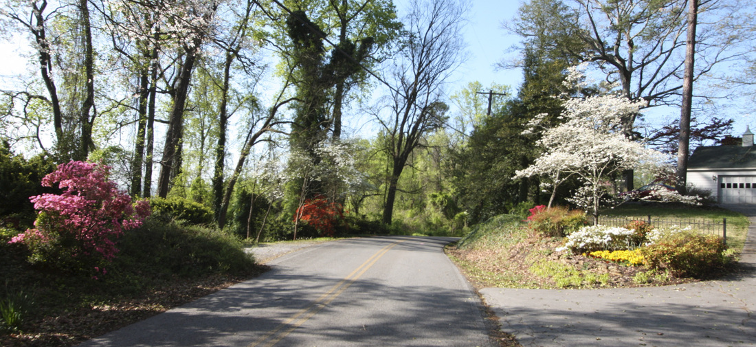
Figure 4-J: Scene at Cawrse and Bond driveways to 3420 and 3425
Timberlake Drive has been featured on the Loudon Lake Dogwood Trail since 1965 – for a good reason: in the one-mile stretch from Montlake Drive to Maloney Road, there are at least 110 dogwood trees in front yards and along the right-of-way, with dozens more in back yards and down the four side lanes. Many of the wild dogwoods were allowed to grow along embankments, and some of the mature, shapely trees were planted by original residents of the community. Other past and current residents have continually replaced and planted new dogwoods, along with azaleas and other ornamental trees, flowers and shrubs.
In the welcoming letter to the Timberlake Community Club from the Dogwood Arts Festival in 1965, the chair of the dogwood trails described the newly formed Loudon Lake Dogwood Trail as “everything a trail should have: beautiful homes, attractive lawns and gardens, natural profusion of wild dogwood… plus views of the lake and mountains unparalleled anywhere else in East Tennessee.”
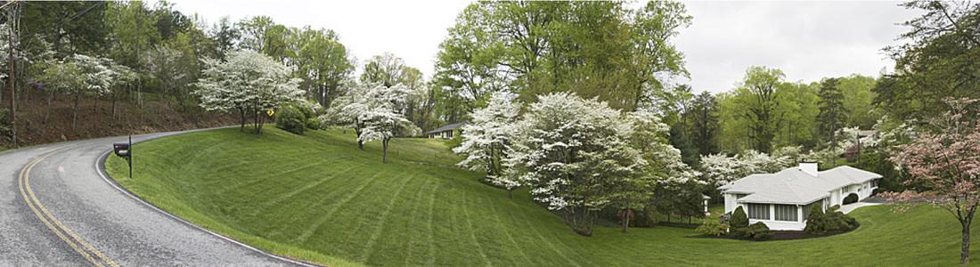
Figure 4-I: Dogwoods along the Louise Woods property at 3301 Timberlake at corner of Montlake. Photo: Reiff, 2008
Trees of Timberlake
In years prior to the Maloney Heights development, timber likely was targeted by high-grade harvesting; however there is a good mixture and variety of native species remaining. Various oaks and yellow (tulip) poplars are in abundance throughout the neighborhood, along with a few shortleaf pines, maples and ash. Hickory, sweetgum, and beech trees can be spotted on the wooded lawns as can a few hemlocks, red cedars and white pines. Along the creek on the northwest border of the neighborhood there are sycamores and at least one Chinese chestnut. Yards have been landscaped with decorative trees such as magnolias, weeping cherry, crabapple, pear, and redbud, resulting in spectacular spring blooms. The highlight of autumn color perhaps is the annual brilliant cascade of yellow gingko leaves in front of the Pinkston’s home at 3600 Timberlake.
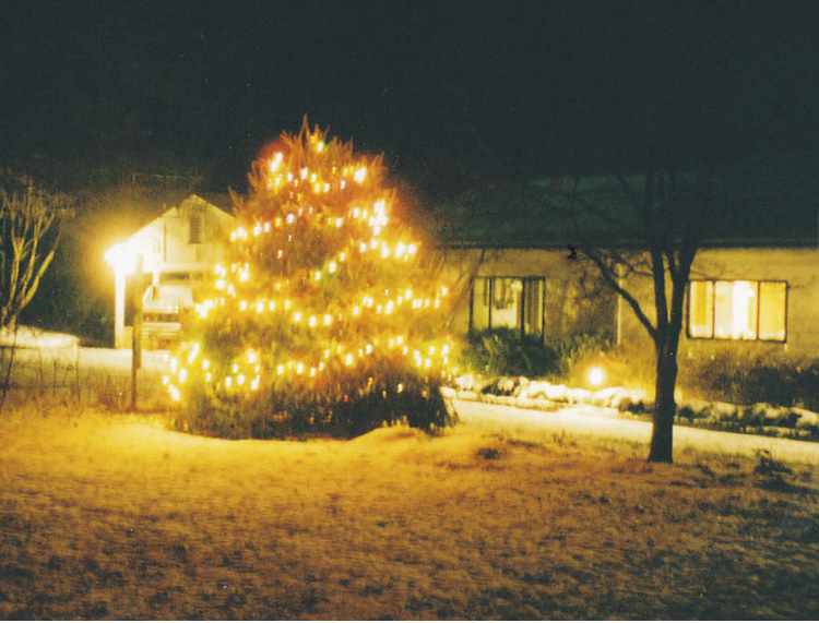
A few trees are gone, but not forgotten, including a hemlock in front of 3715 Timberlake which the Rennie’s decorated for the holidays, and a 150-year old oak tree in the back yard of the Hake’s at 3524, which was struck by lightning in 2001. Some of the felled oak was milled into lumber and lives on through David Hake’s woodworking projects.
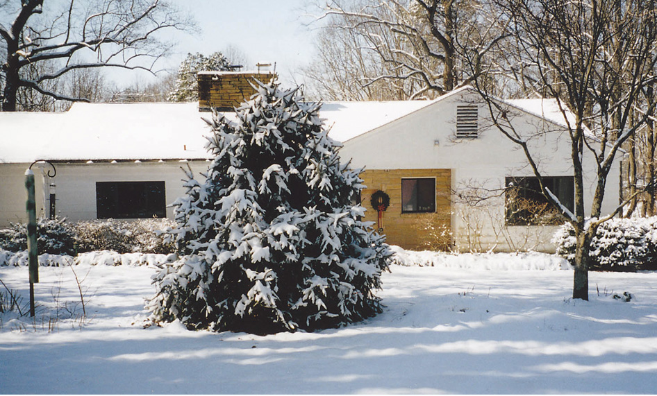
Figure 4-K: Hemlock formerly in front of the Rennie home at 3715 Timberlake. Photo: Hake
|
|
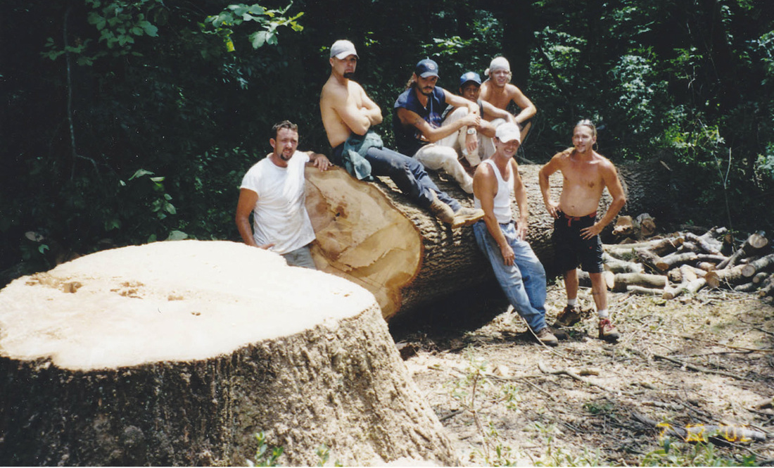
Figure 4-M: Felling of the 150-year old oak tree in the Hake’s back yard at 3524 Timberlake. Photo: Hake, July, 2001
|
Two beech trees near the road at 3715 Timberlake may be the most impressive trees in the neighborhood. It’s been told that the Timberlake roadway was deliberately routed around the trees instead of cutting them down. The pair are of similar size and age, yet they show individual personalities by changing color at different times in the fall. Summertime views of the beeches are pictured below (click to enlarge).
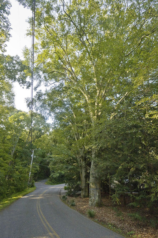
Figure 4-N1: View of beeches looking southwest on Timberlake. Photo: Reiff, 2009
|
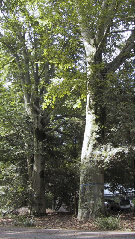
Figure 4-N2: Two beech trees at 3715 Timberlake (Rennie, Lot 14), 32.5 inches and
36 inches in diameter. Photo: Key, September 2009
|
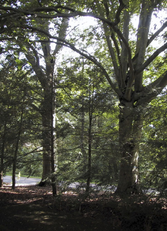
Figure 4-N3: View of two beech trees from the front yard of 3715 Timberlake. Photo: Key, September 2009
|
Other Notable Timberlake Trees
Figure 4-O: Hickory at 3320 Timberlake (Nowell, Lot 39)
Photo: Reiff, October 2009
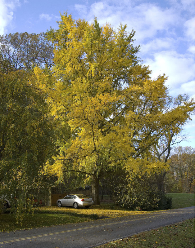
Figure 4-R: Stunning Gingko at 3600 Timberlake (Pinkston, Lot 19)
Photo: Reiff, November 2009
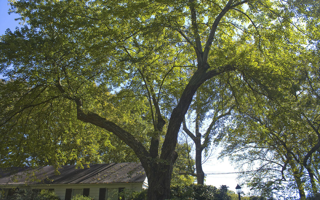
Figure 4-U: Silver Maple in front of 3416 Timberlake (Lot 32). Photo: Reiff, October 2009
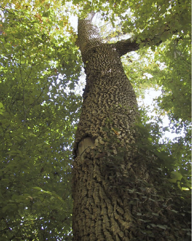
Figure 4-X: White Ash at 3621 Maloney Road (Burr, Lot 16), largest ash in the neighborhood
Photo: Key, October 2009
|
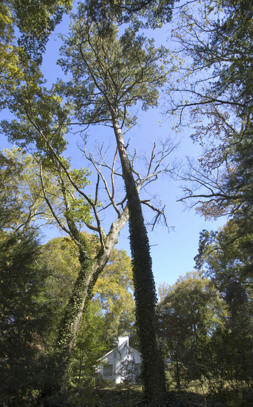
Figure 4-P: A towering short leaf pine at 3708 Timberlake (Hodges, Lot 39) is visible from outside the neighborhood boundaries Photo: Reiff, Oct. 2009
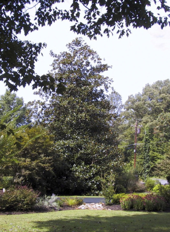
Figure 4-S: The Magnolia between 3524 and 3600 Timberlake (Hake and Pinkston, Lots 21 and 19) was a birthday gift to the Hesslers from the Witherspoons.
Photo: Key, September 2009
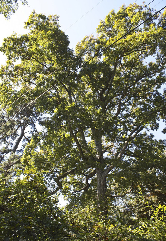
Figure 4-V: White Oak at 3425 (Bond, Lot 26)
Photo: Reiff, October 2009
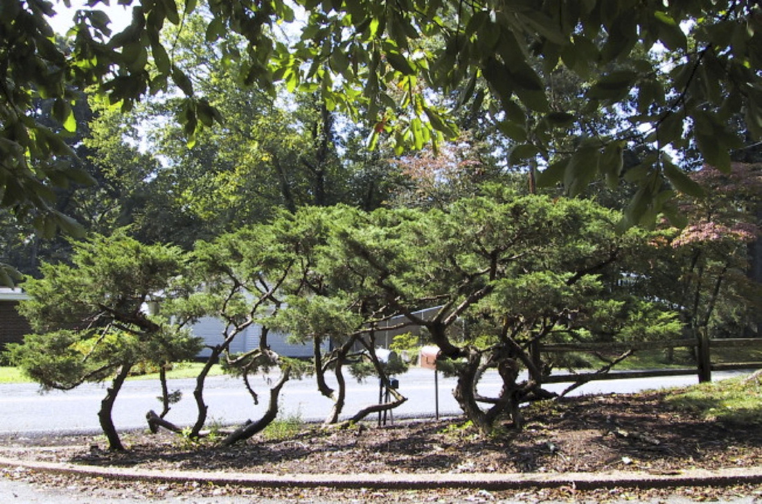
Figure 4-Y: Ornamental juniper at 3417 (Warren, Lot 24) Photo: Key, September 2009
|
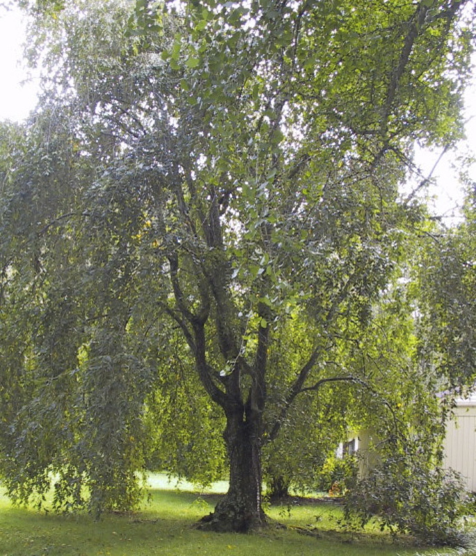
Figure 4-Q: Weeping Cherry at 3600 Timberlake (Pinkston, Lot 19) Photo: Key, September 2009
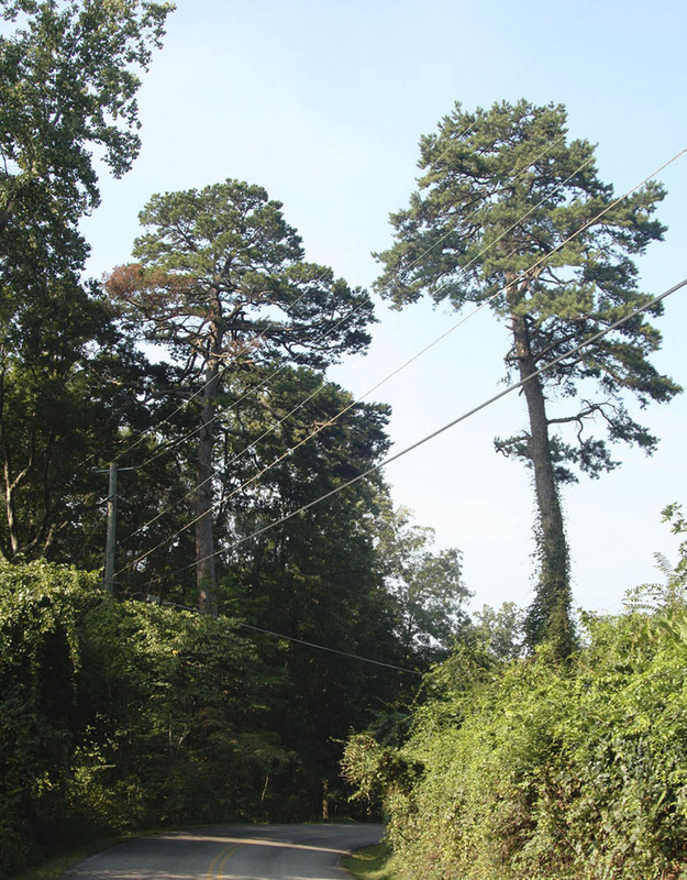
Figure 4-T: Two shortleaf pines on both sides of Timberlake at 3425 (Bond, Lot 26) Photo: Reiff, August 2009
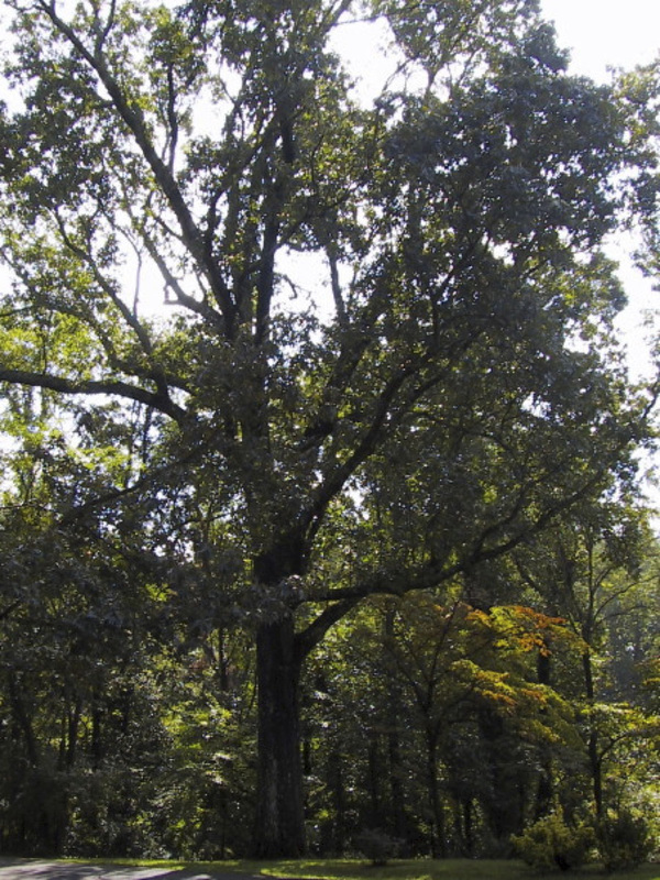
Figure 4-W Red Oak at 3516 (Sadler, Lot 25)
Photo: Key, September 2009
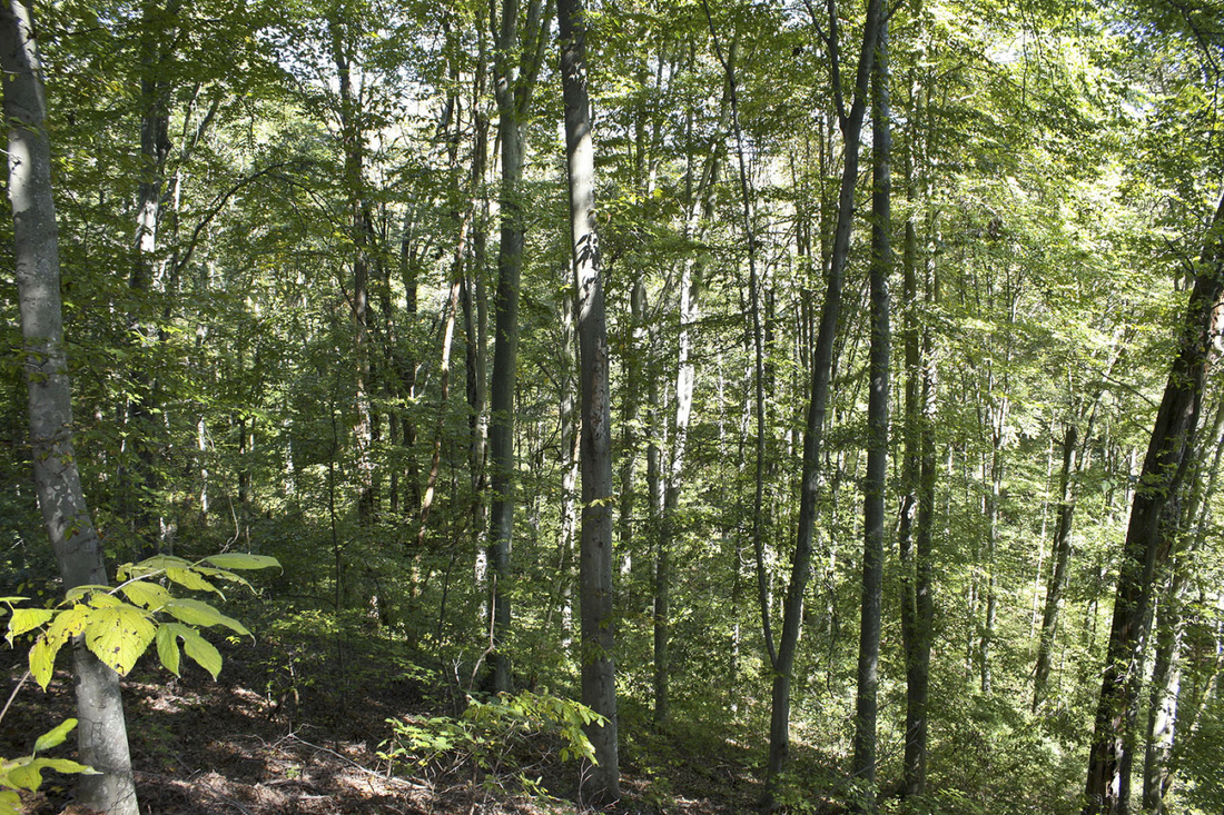
Figure 4-Z: Beech grove at 3612 Timberlake (Callaway, Lot 17) Photo: Reiff, October 2009
|

